
Malam Jabba Trip (1 Day) 05/10/2023 - 31/12/2023
per personRs0.00
- 1 Day Trip
- Malam Jabba - Swat
- Travel + Fuel
- Bookings Open
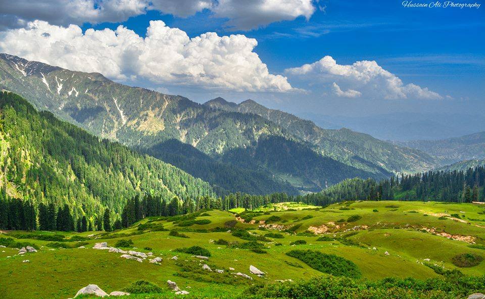
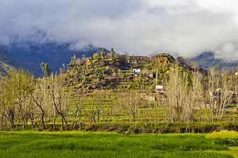
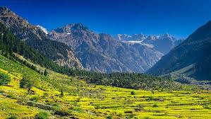
The Lush Green and historical Swat Valley, in the Malakand Division lies between 34o-40’ to 35 N latitude and 72 to 74 -6 E Longitude and is part of the KPK province of Pakistan. The valley is an integral part of the strategic and significant region where three part of Asian continent south -South Asia, Central Asia and China Meet The Name found is ancient sources of swat and udyana and suvastu because of the scenic beauty of the valley and the name of the river respectively. The Historical and cultural remains of the area provide evidence about humans activities covering a large span of time .Alexander the great came here in 327BC route India. In ancient time it remained center of Buddhism still having its marks found from river bed to the top of the mountain .During Abdul Wadud (1917-1949) and Jahan Zeb (1949-1969) peaceful region ,Swati territories forming part of swat state witnessed unprecedented development in the field of education, health and communication The magnificent swat valley popularly known as the Switzerland of East ,is Situated north of Peshawar .in Ancient times its remained center of the flourishing Buddhist civilization still having it remain found at tour places .its old name was udyana .surrounded by majestic mountains .the archeological sites and monasteries add to its historical charmupper and lower swat are terms in vogue based on the arbitrary demarcation of higher and lower region in the valley by swat river .Green fruits Orchard beautiful lakes ,gushing streams and a fascinating landscapes make it a place worth seeing
Swat is well connected with important cities like Islamabad /Rawalpindi and Peshawar via Road (See and Section How to Get There? Air Route: the twice weekly flight (30 min journey) to swat from Islamabad and Peshawar was still suspended at the time of compiling this application (Check from Travel Agent) If leaving from Peshawar or Islamabad the route Swat is via Mardan .From Mardan the main road to swat leads north over the historic Malakand Pass .Swat Distance from Peshawar is 151 km .The distance from Rawalpindi via Noshera –Mardan and Malaknd Pass is 270km.Dargai and Batkhela are main town en route until one reaches Chakdarra and which is another town steeped in history .Here the road forks into two .One Leading towards Chitral and another towards Swat .The Chakdara Fort Guard The Area. An Important port on the hill is the farmed Churchill Picked (or Piqued) a Small fort built in 1896.Winston dealt with in much details in the autobiographical the story of the Malakand field Force Note: Visitors and Tourist are advised to carry their identification Cards /Documents with them to avoid Inconvenienced at routing security checking point en route
In order to facilitate the tourist and ensure their utmost safety KP government has launched a tourist police force in swat .Earlier in June 2017 a similar tourist police force was launched for the region of Abbottabad and nathigali . According to the district police man was setup in the Nathiagali division. These policemen have been trained by the police department as well as by tourism department. The tourist police force would remain operational around the clock Moreover, this police force has been specially trained to handle accidental and other criminal activities related to tourism. The Tourist Police squad consists of 40 policemen having 20 motorbikes.
Pashto and kohistani are the commonly spoken languages while Urdu and English are also spoken or understand by the people.
Decorative household articles and colorful embroidered items are trademark of swat valley. Embroidered table cloths ladies shawls mats, handicraft caps woods furniture, and honey are popular items. Swat is world famous for its precious and semi-precious stones particularly its emerald.
The best season to visit swat is from March till October amidst pleasant weather. April is green and flowery month of spring while October is the golden month of autumn, June, July and August are month when dwellers of hot plains of the country swamp the valley to escape the heat of summer. it is time when the valley welcome all kind of tourists amidst its magnificent mountains meadows forest and streams providing the perfect retreat.
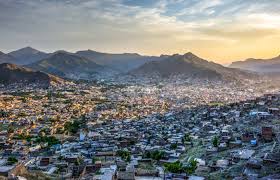
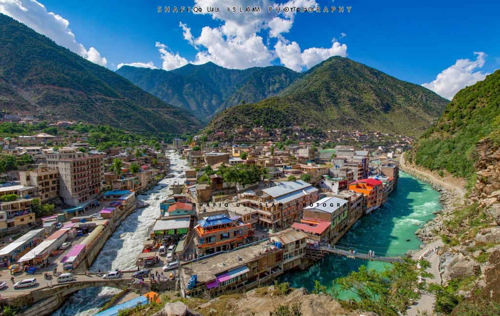
Mingora (Pr: Mingawra ) the center of Economic activities and the only Urban area of the valley is adjacent to Saidiu Sharif .It Offers Traditional .Pakistani and western food outlet ,restaurant and hotels locally produced beautifully displayed at its main bazaars shops rooms etc. .Include semi-Precious Stones, Embroider Dresses, Hand Woven ladies Shawls, Bed Sheets and woodwork .Traditional Ornaments and antiques are available at shops .Visitors On Trips to Swat Valley Usually Strolls in its bazaars for shopping at the end of their journey .You can find emerald mines in hills Northwards of the city, famous worldwide for their expensive and Valuable emeralds.
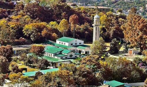
Being the Capital of Swat Valley ,Saidu Sharif is the principal seat of administration for looking after and managing regional government affairs .several collages schools collages governments offices and situated here .Swat Museum the Tomb of the Akhund of Swat beautifully built building of Swat state era,espically Jahan Zed Collage wooden building of Mehmankhana and archeological site of butkara 1 2 and 3 are worth seeing Places in Saidu Sharif
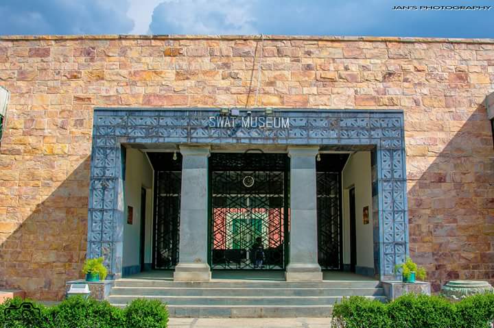
This Museum has a huge and precious collection of Ghandara Art. Artifact stupas coins of various ages and other assets of Ghandara civilization signify the rich cultural and historical past of valley .The museum is situated on the main Mingora –saidu sharif road. The artifact ,antique and similar article are categories and beautifully showcased cultural life of the near past of the valley is displayed is shape of local dresses, embroidery jewelry musical instruments weapons of old time and carved wooden articles . The Museum is Closes on Friday.
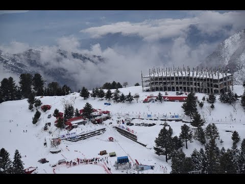
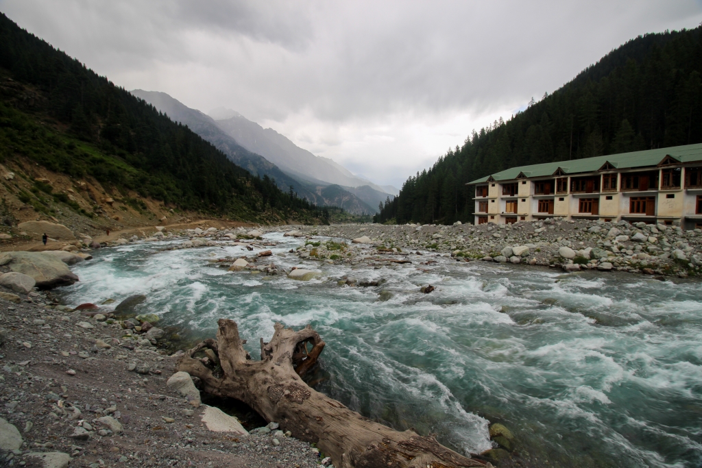
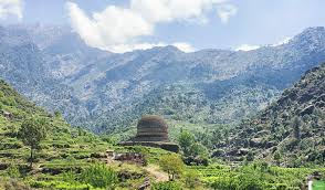
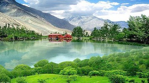
A Trip is incomplete without seeing Malam Jabba about 44 km from Mingora a modern hill resort with surrounding mountains enhancing its natural attraction and beautiful landscape. A Majestic landscape adorned with snowy mountains peaks lush green valley and sprawling forest. Malam jabba is the star destination in Swat for adventure seekers. About 44 km from Mingora this modern hill resort swarming with enthusiastic tourist once housed a winter ski resort which unfortunately failed to stand test of time. therefore in a attempt to restore the grandeur of the area and attract domestic and foreign skiing lover TCKP in September 2015 awarded the restoration of a state of the art ski resort equipped with a new chairlift and skiing resort were inaugurated while the construction of the hotels is in the final stage .Malam Jabba offers beautiful landscape of mountains peaks full of snow , green valleys and sprawling forest refreshing mind in a cool and more serene atmosphere generously gifted by nature .
About 13 km form Saidu Sharif ,is situated the serene small town of Marghuzar at foot of mount Elum .Its white Marble Palace built by the ruler of swat in 1940. Add to the grandeur of this peaceful small valley .The place has now seen converted into top calss hotel with excellent lodging and boarding facilities .while voyaging towards Marghuzar you can see road turning towards salampur , a small village famous for its wool cottage industry
Encircled by mountains, this picturesque tourist resort of maindam is at a distance of about 57km form saidu sharif ,surrounding mountings during the summer do not allow the sun to cast its shadows on this attractive resort making it the coolest place in the area .A PTDC motel few hotels are official guest houses keep this beautiful place alive in the summer season .it provide a refreshing view of large forest ,fruits orchard and flowing streams.
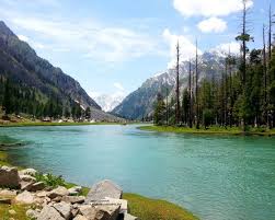
The valley of Madyan is situated about 56 km to north of Mingora city .it lies on the main road that leads to Bahrain kalam and other beautiful valley of swat. Its riverside location and cool climate make it an attractive spot with row of shops hotels and restaurants queued along the road .A trout hatchery adds to its fascination. Local handicraft, embroidery and antiques are displayed at roadside shops. The slightly wider valley of Madyan is different in comparison to other valley in the sense that almost every type of modern facilities and amenity is available here i.e. internet cellular networks cable and satellite TV , Hotels , restaurants and other basic necessities of life Aprt from these up to date facilities ,tall mountains covered with green foliage and dotted with small mud and concrete houses form three sides surrounded the beautiful town of Madyan .The roaring and foaming river Swat Look like a ferocious monster here as the huge mountains on both sides appear to fetter and restrain its movements.
The Sprawling valley of bishgram is the latest village on the road. The houses are built like gigantic steps on the uneven landscape of the mountain. The total time to reach the valley from Mdayan is forty minutes as the road is not in good condition. Several Other small Hamlets surround the valley. Which can be approached by trekking for an hour and a half? The track to Bishigram Lake starts from village and that’s how it has taken its name. Lush green forest surrounds the valley which received heavy snowfall. Several springs and streams are scattered throughout the valley .Electricity and telephone facilities are available. The area is no more secluded and the people visited the nearby town of madyan almost on daily basis to merchandise their goods .and buy the daily consumable items .Most of the inhabitants live permanently here while the adjoining hamlets are deserted during winters and are occupied in the summer again . The people are very hospitable and welcome everyone in their beautiful locals .Most of the people rely on farming and grow maize and off season peas. Which get them lucrative price in the market the people speak Pashto and Kohistani languages but the letter is dominant language in the area. Their dialects are different. The people are very traditional and some old customs related with matrimony are still followed there. Some small shops in the area provide the daily consumable sunburned as the area situated at fairly high altitude from sea level. the beauty of the valley and genicial hospitality of the people are some of the wonderful memories which the visitor are sure to take back with them after visiting the rustic and pastoral locals of Bishigram.
This Small riverside town at a distance of 66 km from saidu sharif and just 10km from madyan is most frequently visited resort because of its location on the road leading to other beautiful resort. A humming bazar with shop eateries and hotels make it a popular place. Household traditional decoration items are available at shops Architectural beauty is fully evident in wooden made pillars are fixtures of mosques and buildings are arousing interest of visitors. Nearby valleys full of lush green thick jungles offer hiking on narrow mountainous paths.
Being the Home town of Kohistani inhabitants, Kalam is like an earthly paradise in swat valley. Located at a distance of 40km from Bahrain Kalam is the main town of this region on of the most panoramic natural beauties. The people known as kohistani are its original inhabitants proud of their own language and still unchanged traditional. A Fascination View of 6471m Fala ksiar peak with it melting snow during summers from militant (3000M) is breathtaking. The Picturesque kalam provides roads access to reach magnificent valley of Ushu (2286M) Utort (2225M) and Gabral (22286M) Above sea Level Where journey through green forest and beautiful view of landscape is memorizing .Rivers and lake at kalam offer good trout fishing after getting permit obtainable from the fisheries department. The tourism department Khyber Pakhtunkhwa made special project keeping in view the facilitation for visiting tourist to the valley. The roads have been renovated and road side facilities like rest are parking, tuck shops Toilets and Mosques have been built.
The beautiful valley of Swat is a mix of different and varied valley and plains. The Southern region is comparatively wide and open, consisting of plains that are cultivated throughout the year and yield extremely large quantity of fruit and crop. The residential area for the small mass of population scattered in different groups and families. The valley of mankial is one such places located in the north of swat on the main road leading to kalam . The total distance of the valley from saidu sharif is about 80km. the condition of the road is not good but still the scenic beauty along the swat river keeps the visitor engaged. The Fascinating valley of mankial is famous throughout swat for its several sharp and jugged summits or peaks, which can be seen hundreds of km away from down the plain. The Tallest Peak height is 18750 above form sea level.
The road turning to right hand leads to the beautiful and exotic highland of jabba where the local people of mankail reside in summers growing potaoes and raising livestock’s. The slightly open valley of jabba wears a thick balnckets of cedar or deodar forest decorated by the mosaic of colorful wild flowers and fruits during early spring. The valley is guarded by the sky touching peaks of mount of mankail in the east where huge glacier melt down and from spectacular waterfall which cool the eyes of beholder and reverberate in the valley Several other pastures and grassland situated at a relatively high altitude from jabba including the misty pastures boksar and sor kar can be easily accessed from this area. The sprawling meadows of boksar are incompletely in beauty and are identical with the splendid highland of deosai in Gilgit. these hypnotizing valleys are famous for their rich wild life in which the snow leopard Markhor , Black Bear , Flying Squirrel , golden Monal , Koklas, Pheasant and the bulky snow cock are well known names . Jabba has great potential for eco –tourism, which can be beneficial for the region. A strong initiative from the government and NGOs with support from the local community could certainly make the area prosperous will help to conserve the ecosystem.
it is 16km (10 Miles) up the Utror River to Utror Village .Utror Valley about 2200 meters above from sea level has shaded picnic spot and streams full of fish . The modern Muslims grave in this area is surrounded by intricately carved wooden railing.
Gabral valley is another picturesque valley which is accessible form Utror and is at the terminus of the hiking trails, Kharkharai Lake is located here.
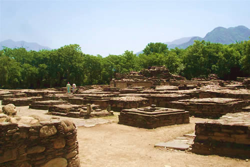
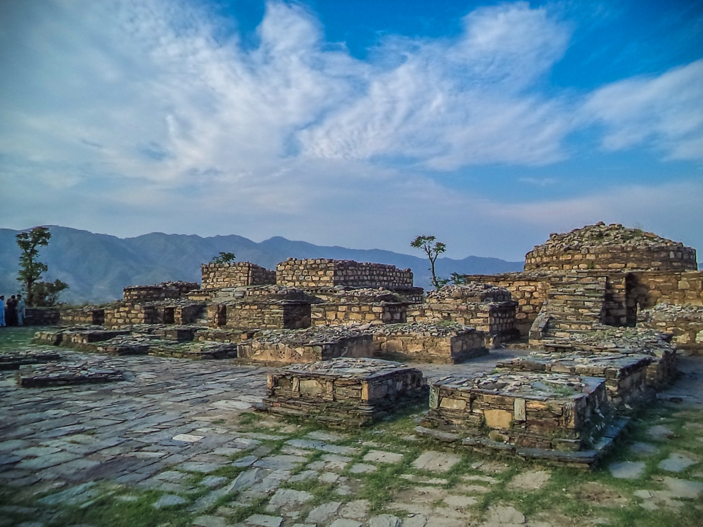
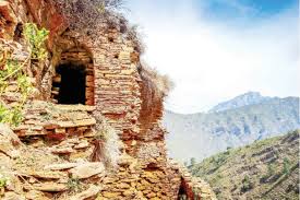
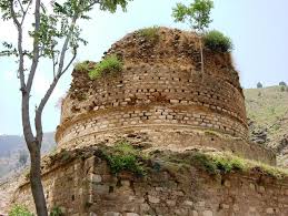
A fairly large number of Buddhist site such as stupas , monasteries , viharas, settlements, caves , rock-carving and inscription are scattered all over the Swat valley . This Heriatge of immense interested may be seen both in plains and in the hilly tracts. Fa-hein , who came to swat in 4th century AD , wrote about 6000 images in the sacred monastery of Talo (Butkara) . The Most famous of all the Chinese pilgrims, Hsuan –Tsang who came here in 7th century AD mentioned 1400 monasteries in swat , which eloquently conferment the extensive remains of the Buddhist period Even today over 400 buddhist Stupas and monasteries may still be seen in ruins in swat covering an area of about 160 square km. the Buddhist built their Stupas and monasteries higher on the hills with the aim that agricultural economy may not suffer and also to provide a sort of protection and security to them form the invader .
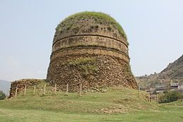
The Buddhist sacred precinct of butkara identified as the monastery of TA-LO mentioned by sung yun (520 AD) visited and described by Chinese Buddhist pilgrims of the 5th 6th and 7th centuries AC lies at the Eastern and of the ancient Capital of Udyana , Meng-chich-li or present Mingora .The Main Stupa stand in the middle around it are crowded monuments ,stupas, viharas and colums . Om the Northern side stand a great Stupa underwent five reconstruction each new incasing the older from 3rd century B.C to 10th century AD.
Location: The Stupa of Shingardar is situated about 3 km to the northeast of brikot Village by the left side on the road from Mingora to Mardan .The Stupa stand in the mouth of small glen descending from a bare spur above the valley plain. Description: The Shingardar Stupa was identified by Colonel Deane and Sir Aurel Stein with the famous Stupa built by king Uttarasena on the Spot where the white elephant that carried the king share of the relics of the Buddha halted When he had arrived at this spot, the elephant suddenly dropped down and dying changed him into rock by the side of this rock. The king at once erected this stupa . This myth of the stupa is derived from a local traditional (Deane 1886 stein 1930) . The tradition war recorded by hieun Tsang who visited Swat in the 7 century AD.
Just 7km form Landakai a road goes towards Nimogram which is further at a distance of 21 km .Nimogram is a famous for its monastery on the top of hill overlooking the whole area .Three main Stupa with several other ones are also found here .These archeological sites revived the Buddhist period of this place .these structures have been built with dressed stoned a mastery by old artisans. They resemble Anden Dheri Monastery situated in Dir district Location: The Buddhist site of nimogram is situated about 45km west of saidu sharif and about 22km from barikot on the right bank of swat river in sub valley of shamozai . This site was discovered in 1966 and excavated in 1967-68 The site: The site consist of three main stupa in a row from north to south with a courtyard of 56 votive stupa and the adjoining monastery on the west of the main stupa . It is difficult to give a definite date to the monument at nimogram . Nevertheless based on the discovery of a few coins of kushana period the site may be tracked back to 2nd and 3rd century AD. Apart from coins and pottery of Scytho-parthain period a large number of stone and Stucco sculptures depict various scenes of Buddhist mythology. These sculptures are on display in Swat museum.
Location: The Stupa of Amlukdar is situated about 2km to north of nawagai village in the beautiful small valley of Amlukdar on the main road to buner . One is required to walk about 1km through the village in order to reach the site Description: The high stupa stand prominently visible from the surrounding area naturally sheltred by the great mount elum . The Stupa is raised on a magnificent square plinth with base moulding in torus and scotia pattern shape base plinth is about 4 meter The height of stupa from the level of ground is up to top of the measure 20 meter. The entire stupa building from base to the top shows a remarkable fine semi ashlar masonry preservation good stretches of the architectural decoration, typical of the Gandhara valley during the kushanas period
Shahkot pass laying between the mura pass on the east and malakand pass on the west is an enchanting valley. On the north east lie plains and small hamlet, shahkot banda with numerous Buddhist settlements. On the south west is located the famous hathi darra , or the elephant paw near village zalam kot about 10 miles from village thanra on the main road leading to swat . A board road about 20 feet wide and measuring 6 miles across the mountains joining both sides of the pass was constructed for the elephant caravan of ruler of the kushan period. This ancient road which came to be known as the elephant paw and the famous queen throne on the top of hillock near hathi darra are feast for the eye and have great tourist potential. The retaining walls on the mountain slope which present the thrilling sight run down to the valley below and stretch from shahkot plains to the village of palai In 9th century AD when Hindu shahi conquered this land the Buddhist were forced to flee and take refuge in the distant mountains of the north .The forces of Mahmud of Ghazna subdued Raja Gira the lat king of Hindu shahi in the early 11th century AD .The Elephant paw and the queen throne are valuable relics of the past. No attempts have been made to excavate to preserve them from further decay.
Location: The Buddhist site of tokar –dara is situated about 5km to south of barikot on the way to karakar pass and lies about 1km from modern village of najigram at the mouth of small picturesque valley. Main Stupa: the large stupa is probably the best preserved in this area. It consists of hemispherical dome, upper and lower drums resting on a square podium and scale. The stupa court is 32 long to south north and 72m east west fortified by a wall. The main stupa was surrounded by the votive stupa which has been completely destroyed by unauthorized relic hunters. Faint traces of the votive stupa can still be seen. Cave: on the eastern side of the glen about 45m above the monastic quadrangle lies a cave with its high entrance which is blocked about half of its height by a wall. This cave probably used by the monk for meditation.
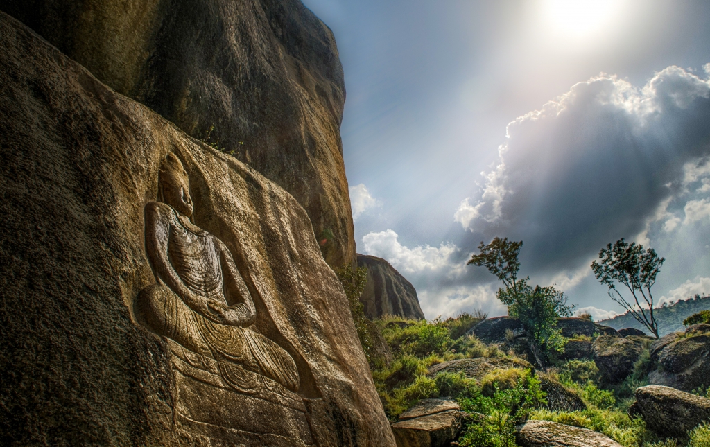
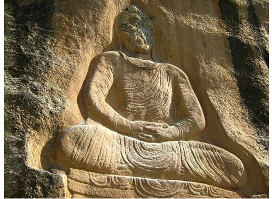
Location: the huge image of seated Buddha carved into rock face of reddish color that rises on the hill side to the southwest of jehanabad (Shakhorai) Village .it is situated at distance of 5km to the N-E of manglawar . This huge image of the Buddha is also visible from road on the right side when one is on the way to Malam Jabba. Description: The Buddha figure is about 7 meter in height and is certainly the most impressive piece of sculpture to be seen in Ghandara region. Unfortunately it was damaged by miscreants in 2008. Traces of this excellent figure of the Buddha remain which is seated on the high throne in the altitude of mediation. The snail shell curls of the Buddha are carefully rendered. His eyes are more than half closed. There is a prominent Ushnish and long ear lobes. The fold of the robe is stringy, with a planned alteration of high and low ridges. Though the figure exhibits the Ghandara style in the drapery with pleats and the hair, the rather solemn, powerful from of the torso and represented of the folds of the robe are in agreement with the usual form adopted in the area for the other figures of Buddha.
Sir Aurel Stein in the memories of the Archeological survey of India first mentioned the site of Gumbatuna in1930. Berger and wright who carried out small scale excavation (Berger et al 1941). Professor G Tucci followed it in 1955-56. Location: The site of Gumbatuna (Gumbatuna is the plural form of Gumbat, the Pashto word for dome) is the Buddhist establishment situated on the right bank of river swat. 6km west of barikot village along the metalled road leading towards Nimogram in a wide valley. The Valley is brodaly drained by the swat river which flows in several braided channels through the area. The archeological remains are scattered over a range of 1500 meter north to south and 1000 meters east to west in wide terraced fields sloping into the hills behind known as Shamozai range. A spring is located in the picturesque gully north of the sacred area. Main Stupa: The lower zone comprises the main stupa encompassed by the votive stupa and columns bounded by wall. The main stupa stands on a square plinth measuring 17m each side with an offset projection 3.71 long by 3.82m wide. The huge stupa Is probably the best preserved in ancient Udhayana consisting of a dome upper and three lower drums. Resting on a square podium and scale The Structure above the dome comprises harmika and umbrellas which are now missing.
Ram Tahkt is one of the sacred places in Hinduism .it is only second to Amarnath Cave regarding its sacredness and sanctity Ram Takht is situated on the top of mount elum at an altitude of 9200 feet seal level. This point is called jogyano sar (yogi peak).The dune of Barikot which is also famous for it sacred ruins is visible from here towards the north west The hindues believe that ram Chandra jee maharajah spent three years on his banbass (jungle life) here The Hindu pilgrims visit this place once a year on first day of sawan to pray worship and seek unity with almighty . A holy spring flows near Ram takht where most of the yogis came to seek unioun with divine entity Ram Takht has also been demolished by treasures hunters in the hope of acquiring ancient treasure. Toorda pacha whose family has esided here since time immemorial says that one of the yogis was killed by a monad in the hope of acquiring wealth. Later the nomad lost his sanity and his whole family disappeared mysteriously from the place Ram Thakt can be accessed through different routes of karakar, Char, Dokada ,Bezo Sar, Amlukdara and marguzar . One can reach the place in five hours from Marguzar easily. Several cool streams adore the way while most of dense forest has been chopped down by timber mafia. The way is well treaded and there is no fear of straying away. The exotic valley of swat and the holy district of buner are the spectacular panoramas visible from ram Thakt. Mount Elum has a profound spiritual and holy past. The famous saint peer baba and durrani Baba has visited this place worshipped and meditated here. Today they are in their eternal slumber in the lap of mount Elum.
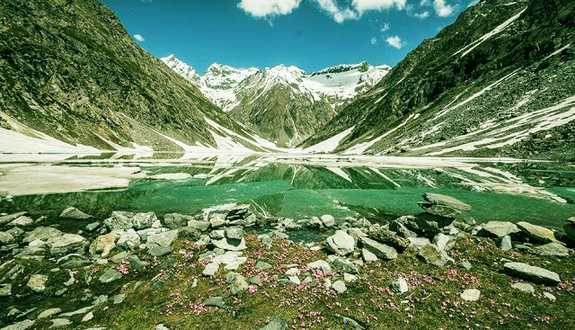
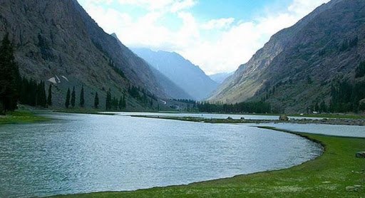
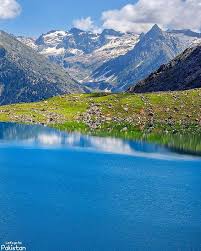
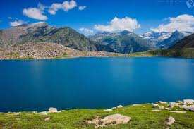
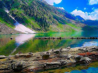
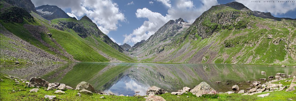
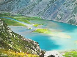
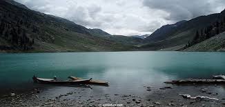
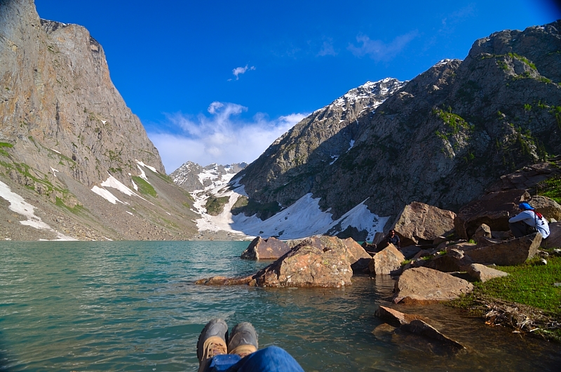
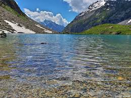
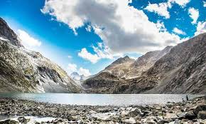
The Valley can truly be called the valley of lakes which is not only feeds the emerald green Rivers Swat but also provides ideal camping site for adventures and nature lover. Most of these lakes are hidden from the world due to their far-flung locations and take three to seven hours trekking to reach from last village on the road. Exploring these miracles of nature demand endurance, patience and courage and above all lover for natural beauty .Only those who possess aesthetic and have a thirst of natural beauty venture to explore and unravel these extravagant bounties of nature.
Bishgram Lake is situated to the east of bishgram valley near Madyan . The road to his valley is partly matalled for vehicles. It takes almost forty to fifty minutes to reach this picturesque valley inhibited by simple and hospitable folk. From here, trekking of four to five hours, depending on professionalism and enthusiasm of the trekking land you in the realm of a serene and enchanting lake of Bishigram.
Daral lake is situated to the northeast of Saidgai Lake and can be accessed through saidgai after two three hours rigorous trekking. The trail to Daral is full of fun and amusement because it runs over sky touching heights of the mountain. It provides spectacular sight and panoramas. A Close look towards the south will reveal the winding silhouette of river Swat disappearing in the distance horizon. After walking and trekking for about two and half hours on bare mountains, the trail start descending towards of east where Daral Lake is located. The descent towards the lake is tricky and treacherous; therefore utmost care and precaution must be taken coming down the gully. Lake Daral is sprawled over a huge area like a giant amoeba. Large rugged and jagged boulder of varous shapes and size surround it. Lush green and exotic flowers blanket the edges of the lake .A rare leaping frog in the lake is a spectacle. The magnificent Daral Lake is guarded and shackled from all sides by gigantic mountains and not even a trickle of water escapes the huge and sprawling lake. The widely held notion that Daral Lake is the origin of Daral River / torrent appears absurd as the lake is literally land locked.
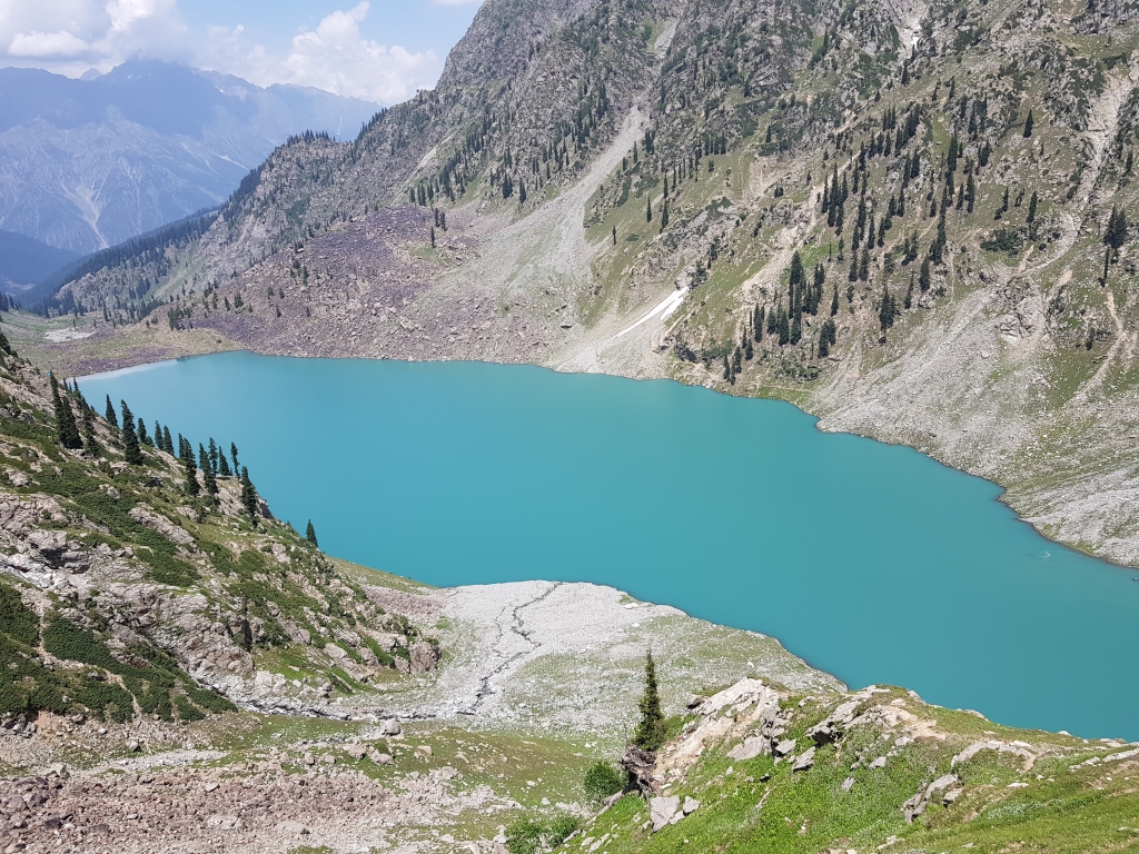
Often described as one of the most scenic spot on earth the mahodand valley which lies in the north 35km from kalam is famous not only among nature lover and escapists but also the exotic trout fish hunters. The valley can be accessed through an un-matalled road from kalam in a four by four vehicle. After driving for about four to five hour from the vast valley of Kalam you will enter the wonderful and spectacular valley of mahodand where the small lakes towering trees and sprawling pastures welcome you. Some temporary restaurants and hotels have been constructed by locals, which provide essential facilities of food and accommodation. They also provide boating facilities in the lakes. The valley is long and wide touches the border of chitral in the extreme north. There is a proper track through which trekkers can either reach shandur topor ghizar in chitral . The river here is divided into a series of small and large lakes which once teemed with brown and rainbow trout fish introduced by the former ruler of swat state. The valley is heaven for trekkers and provides several beautiful camping site with abundance of cool water and firewood. But the trekkers are advised to arrange for their own gas cylinders which will not reduce the burden on gift of nature for those who cherish such thing.
Saidgai Lake is situated in hindukash chain of mountains, interspersed by several small and large lakes which run from the western edges of the pamir plateau west of Karakorum. The mountains have snow covered tops and are crossed by some minor glaciers. Saidgai Lake is located in the peripheries of swat mountain ranges and serves as a huge reservoir of water for husharai khwar Stream Dir The lake can be accessed through three different trails and sides hushirai valley, Dir, Sulatan, Upper swat and Sakhra lalko , upper swat. The lalko name of village trail to the lake is the easiest and breathtaking. a jeepable and unmetalled road ends in the beautiful and exotic valley of lalko where your trekking and hiking chapter starts. From here continuous trekking for almost seven to eight hours will lead you to your desire destination. On the way dark green pine conifer and cedar forest keep you cool and refreshed and small scurrying streams quench your unappeasable thirst bottle water advisable. on the way you will come across a vast pasture which is called gabina jabba (Honey Marshes) in the local vernacular . The pasture wears a blanket of countless arid innumerable variety of flowers of different shades that tempt different species of rare birds and insects. The best season to visit and explore the lake is during the month of july to spetember . In the remaining the thick coat of snow covers the lake and makes difficult fot the observer to differentiate it from the surrounding landscape. saidgai is considered as one of the Largent lake in the area and several adventure loving people swarm the area to discover and explore this spectacular jewel of nature .
Kundal or Kundol Lake is situated in the north of Utror valley. One can easily access it from Kalam via Utror from where a link road ends in a green valley called ladu in the foothills of lake. You can either hike to ladu from utror or it takes almost two hours’ drive to reach the beautiful valley of ladu from kalam . there is also a small hut in ladu where you can take tea and grab something to eat form ladu it take almost three hours to reach lake . Some locals can guide you and even take your luggage for a free. The people are friendly and can provide you guidance if required The Trail to the lake from ladu is easy to follow as a huge stream flows down from the lake which mingles with river swat in Kalam valley. it goes beside the stream and leads you to the lake . the mountains around the lake have scarce trees scattered far and wide but grass and thick vegetation pervade the surrounding landscape that rainforce the beauty of the lake .two other lakes khapiro (fairies) and spin khwar (White Stream) are located in the peripheries of kundal lake and can be accessed through the lake in five to six hours . Visit all the three lakes in one go takes almost four days and night, which can be rather fatiguing. The length and width of the lake is one kilometer during full moon the dim and cool light of the bright moon transform the whole atmosphere like magic. The panoramic galaxies of stars twinkle and sparkle in crystal clear skies.
The name izmis means caves in kohistani and as lake Is surrounded by several natural caves the people name the lake after three caves. Izmis lake is located to the north east of Utror valley at as high altitude above the tree line. A small jeepable link road from utror leads towards the location of the lake which ends in a valley called Loypanrghalay. The lake can be accessed from here after trekking for almost two hours. A small hamlet called kalam banda is located on this eye soothing highland where the grazers welcome everyone in their own special rustic style. The grazers who go to the pasture mostly belong to utror valley .The signs of technologies arrival can be observed here as the grazers have built a hydro power plant to avail the water and electricity in this awesome height. The lake lies almost at distance of one hour from the heavenly locals. Izmis is a huge lake with shallow depth and little water. Most of the water which feed the lake comes from the surrounding glaciers and small springs. Izmis lake shows clear signs of ecological decline which if not timely tackled will result in the extinction of this important source of fresh drinking and irrigation water and will destroy and important temporary and vital residing ground for the migratory birds. The lake needs urgent attention from environmentalist due to natural and human made threats otherwise this important lake will became a fragment in the unending annals of history.
Pari Lake is one of the Lake in swat region which is located at very high altitude at the foot of the tallest peak in the range with a considerable depth. The name pari or khapiro is given the lake due to the widespread belief that the lake is the abode of fairies where they live and bathe in the cool pure and clear water of the lake .it is located north east of Utror Valley and can be accessed only by trekking .Trekking to lake need endurance and love for nature as the trail is exasperating as well as dangerous therefore utmost care should be taken while trekking on the narrow bends and turns leading to the lake. The lake is access able from both Izmis and kundal lakes. Two ascending tracks leads to the lake form kundal and Izmis Lake, taking almost five hours to reach this rooftop of swat. The trail steep on both sides SO WATCH YOUR STEP! The lake is surrounded by sharp and jugged rocks and peaks with scanty grass and flowers growth . Pari Lake is small lake which feeds the greater pari lake located below it .the lake is triangular in shape and is surrounded by tall mountains with western face opening to the greater pari lake. Several white gushing waterfalls from surrounding peaks and glaciers feed the lake with crystal clear water.
Pari Lake 2 is located at the highest altitude in the mountails ranges of swat nere pari Lake 1. It comparatively greater in size and depth than the other lake, situated in its vicinity and remains open in the month of July till September. The Western face of the lake is open and its water flows down to the gigantic kundal lake which is situated in the foothill down. The towering mountains surrounding the lake are a safe haven for the bulky snow cock and brightly colored monal pheasant. Therefore a tent must be taken if someone want to stay a night here (Tip: Due to the sheer altitude of the lake location no fire wood can be found. therefore a gas cylinder most be on the top of your trekking list) The lake is most quarter a kilometer in length and is surrounded by steep pasture where the grazers take their livestock pari or fairy lake 2 is a place worth visiting not only due to its ecological importance but the immense natural recreational potential lake possesses
Spin khwar is a beautiful lake hidden in the lap of mountains towards the north of Kundal Lake and east of utror valley. The name khwar has clear significance as a small white stream in the east flows down to the lake form surrounding mountains and is major source of water for the lake. The lake is accessable through two n tracks one from kundal and the other from ladu valley. The track from ladu is comparatively easy to walk asd less tiring while the track from kundal is not only difficult but alarmingly dangerous although it is short and linked kandal and spin khwar . The grazer in the area have built condition due to lack of maintenances Spin Khwar Lake has formidable size and depth surrounded by tall mountains on all sides except the western face from where a stream of water in invisible under the rocks and boulders flows down to river swat. It is rarely visited lake due to lack of publicity and popularity. The lake can become a famous recreational spot of proper track and other necessary facilities are made available to the visitors.
this is located at a distance of roughly 10 km from mahodand and takes on day to reach here . the hike is gentle and the trek ascending gradually. There is a camping area near the lake where tourist can pitch their tent and spend a day or two comfortably a little further is the katchikuni top pass which leads into neighboring Chitral
Another beautiful site roughly 6 km beyond the Kundol Lake. it is located roughly between kalam and kundol in upper Swat
Follow Us